Geolocate

Forrest topographic map

Interactive map

Click on the map to display elevation.

About this map

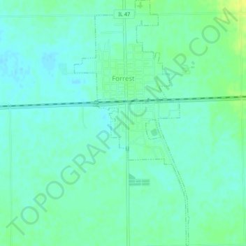
Name: Forrest topographic map, elevation, terrain.

Location: Forrest, Livingston County, Illinois, 61741, United States (40.73110 -88.41922 40.76175 -88.40027)

Average elevation: 696 ft

Minimum elevation: 673 ft

Maximum elevation: 735 ft

Other topographic maps

Click on a map to view its topography, its elevation and its terrain.

Pontiac

United States > Illinois > Livingston County

Pontiac, Pontiac Township, Livingston County, Illinois, 61764, United States

Average elevation: 653 ft

Long Point

United States > Illinois > Livingston County

Long Point, Livingston County, Illinois, United States

Average elevation: 640 ft

Odell

United States > Illinois > Livingston County

Odell, Livingston County, Illinois, 60460, United States

Average elevation: 715 ft

Dwight

United States > Illinois > Livingston County

Dwight, Livingston County, Illinois, United States

Average elevation: 636 ft

Cornell

United States > Illinois > Livingston County > Cornell

Cornell, Amity Township, Livingston County, Illinois, 61319, United States

Average elevation: 630 ft

Cornell

United States > Illinois > Livingston County

Cornell, Amity Township, Livingston County, Illinois, United States

Average elevation: 633 ft