
Steubenville topographic map
Interactive map
Click on the map to display elevation.
About this map
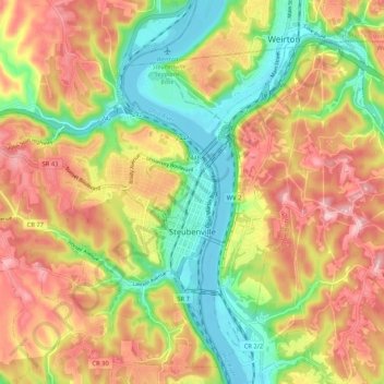
Name: Steubenville topographic map, elevation, terrain.
Location: Steubenville, Jefferson County, Ohio, 43952, United States (40.32823 -80.69751 40.40837 -80.60765)
Average elevation: 971 ft
Minimum elevation: 650 ft
Maximum elevation: 1,266 ft
Jefferson County trails, hiking, mountain biking, running and outdoor activities
Other topographic maps
Click on a map to view its topography, its elevation and its terrain.