
Shoals topographic map
Interactive map
Click on the map to display elevation.
About this map
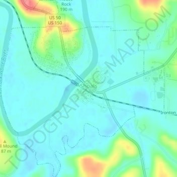
Name: Shoals topographic map, elevation, terrain.
Location: Shoals, Martin County, Indiana, 47581, United States (38.65228 -86.80848 38.67970 -86.77608)
Average elevation: 499 ft
Minimum elevation: 446 ft
Maximum elevation: 689 ft
Martin County trails, hiking, mountain biking, running and outdoor activities