
Gaylesville topographic map
Interactive map
Click on the map to display elevation.
About this map
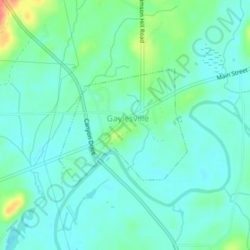
Name: Gaylesville topographic map, elevation, terrain.
Location: Gaylesville, Cherokee County, Alabama, United States (34.26161 -85.56594 34.27376 -85.54912)
Average elevation: 591 ft
Minimum elevation: 548 ft
Maximum elevation: 728 ft
Cherokee County trails, hiking, mountain biking, running and outdoor activities
Other topographic maps
Click on a map to view its topography, its elevation and its terrain.