
Glendale topographic map
Interactive map
Click on the map to display elevation.
About this map
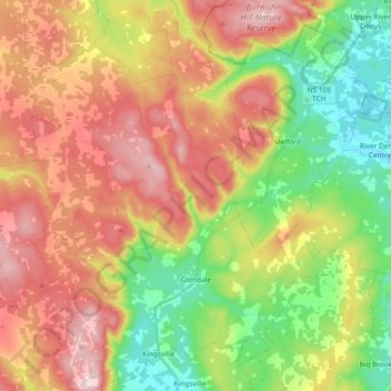
Name: Glendale topographic map, elevation, terrain.
Location: Glendale, Nova Scotia, B0E 3L0, Canada (45.77930 -61.41469 45.90804 -61.24586)
Average elevation: 482 ft
Minimum elevation: 13 ft
Maximum elevation: 997 ft