
Brent topographic map
Interactive map
Click on the map to display elevation.
About this map
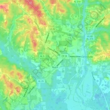
Name: Brent topographic map, elevation, terrain.
Location: Brent, Bibb County, Alabama, 35034, United States of America (32.90801 -87.20474 32.98341 -87.14866)
Average elevation: 276 ft
Minimum elevation: 184 ft
Maximum elevation: 482 ft