
Champaign Island topographic map
Interactive map
Click on the map to display elevation.
About this map
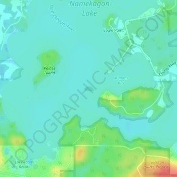
Name: Champaign Island topographic map, elevation, terrain.
Average elevation: 1,414 ft
Minimum elevation: 1,375 ft
Maximum elevation: 1,535 ft
Bayfield County trails, hiking, mountain biking, running and outdoor activities
Other topographic maps
Click on a map to view its topography, its elevation and its terrain.
Bayfield
United States > Wisconsin > Bayfield County
Bayfield was named in 1856 for Henry Bayfield, a British Royal Topographic Engineer who explored the region in 1822–23. A post office has been in operation at Bayfield since 1856.
Average elevation: 804 ft