
Ferndale topographic map
Click on the map to display elevation.
Exploring new terrains?
Equip yourself with the best gear to stay comfortable and safe:
As an Amazon Associate, this site earns from qualifying purchases at no extra cost to you.
About this map
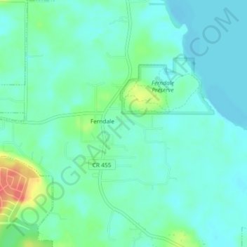
Name: Ferndale topographic map, elevation, terrain.
Location: Ferndale, Lake County, Florida, 34729, United States (28.60564 -81.71652 28.63750 -81.68265)
Average elevation: 92 ft
Minimum elevation: 49 ft
Maximum elevation: 226 ft
Lake County trails, hiking, mountain biking, running and outdoor activities