
Parker topographic map
Interactive map
Click on the map to display elevation.
About this map
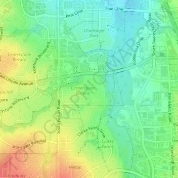
Name: Parker topographic map, elevation, terrain.
Location: Parker, Colorado, United States of America (39.52957 -104.79334 39.53456 -104.78062)
Average elevation: 5,827 ft
Minimum elevation: 5,751 ft
Maximum elevation: 5,935 ft
Other topographic maps
Click on a map to view its topography, its elevation and its terrain.
Cherry Creek Highlands
United States of America > Colorado > Parker > Cherry Creek Highlands
Average elevation: 5,948 ft