
Briar Hill topographic map
Interactive map
Click on the map to display elevation.
About this map
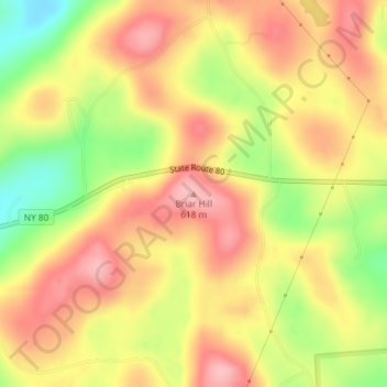
Name: Briar Hill topographic map, elevation, terrain.
Average elevation: 1,827 ft
Minimum elevation: 1,549 ft
Maximum elevation: 2,018 ft
Otsego County trails, hiking, mountain biking, running and outdoor activities
Other topographic maps
Click on a map to view its topography, its elevation and its terrain.
Burlington Flats
United States > New York > Otsego County > Town of Burlington
Average elevation: 1,470 ft