
Briar Hill topographic map
Interactive map
Click on the map to display elevation.
About this map
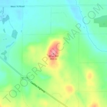
Name: Briar Hill topographic map, elevation, terrain.
Average elevation: 1,056 ft
Minimum elevation: 945 ft
Maximum elevation: 1,280 ft
Other topographic maps
Click on a map to view its topography, its elevation and its terrain.
Central Michigan University Intramural Sport Fields
United States of America > Michigan > Mount Pleasant
Average elevation: 801 ft
Lake Columbia
United States of America > Michigan > Jefferson
Lake Columbia is a small man-made lake in Columbia Township in southern Jackson County in the U.S. state of Michigan. Originally formed as a mill pond in 1836, it was expanded to 840 acres (3.4 km2) in 1961. At its greatest extent, the lake is 2 and 1/4 miles long and 1 and 3/4 miles wide. It has approximately…
Average elevation: 1,007 ft
Stinchfield Woods
United States of America > Michigan > Dexter Township > Dover
Average elevation: 912 ft