
Collingdale topographic map
Interactive map
Click on the map to display elevation.
About this map
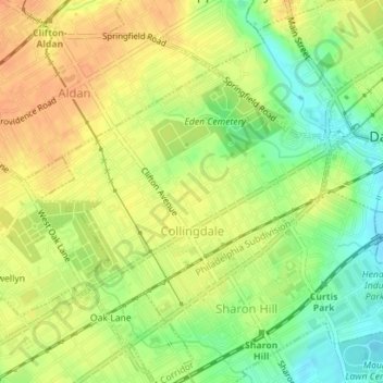
Name: Collingdale topographic map, elevation, terrain.
Location: Collingdale, Delaware County, Pennsylvania, United States (39.90581 -75.29157 39.92323 -75.26320)
Average elevation: 92 ft
Minimum elevation: 16 ft
Maximum elevation: 148 ft
Delaware County trails, hiking, mountain biking, running and outdoor activities
Other topographic maps
Click on a map to view its topography, its elevation and its terrain.