
Ashland topographic map
Interactive map
Click on the map to display elevation.
About this map
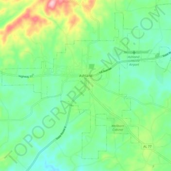
Name: Ashland topographic map, elevation, terrain.
Location: Ashland, Clay County, Alabama, United States (33.23632 -85.88124 33.30201 -85.78924)
Average elevation: 1,093 ft
Minimum elevation: 909 ft
Maximum elevation: 1,539 ft
Clay County trails, hiking, mountain biking, running and outdoor activities
Other topographic maps
Click on a map to view its topography, its elevation and its terrain.