
Cabool topographic map
Interactive map
Click on the map to display elevation.
About this map
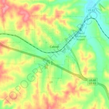
Name: Cabool topographic map, elevation, terrain.
Location: Cabool, Texas County, Missouri, United States (37.09898 -92.13434 37.14046 -92.06187)
Average elevation: 1,329 ft
Minimum elevation: 1,184 ft
Maximum elevation: 1,499 ft
Texas County trails, hiking, mountain biking, running and outdoor activities
Other topographic maps
Click on a map to view its topography, its elevation and its terrain.