
Warrenville topographic map
Interactive map
Click on the map to display elevation.
About this map
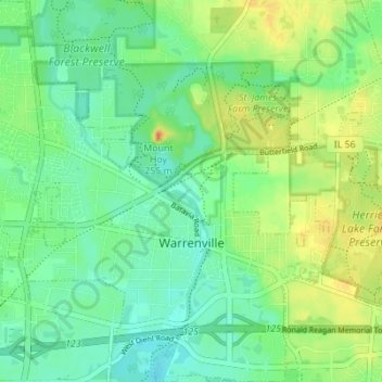
Name: Warrenville topographic map, elevation, terrain.
Location: Warrenville, DuPage County, Illinois, 60555, United States (41.79922 -88.21494 41.85058 -88.14848)
Average elevation: 732 ft
Minimum elevation: 676 ft
Maximum elevation: 827 ft
DuPage County trails, hiking, mountain biking, running and outdoor activities
Other topographic maps
Click on a map to view its topography, its elevation and its terrain.
Downers Grove
United States > Illinois > DuPage County > Downers Grove > Downers Grove
Average elevation: 745 ft