
Town of Drammen topographic map
Interactive map
Click on the map to display elevation.
About this map
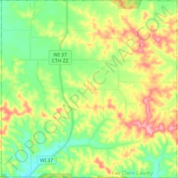
Name: Town of Drammen topographic map, elevation, terrain.
Average elevation: 1,001 ft
Minimum elevation: 840 ft
Maximum elevation: 1,243 ft
Other topographic maps
Click on a map to view its topography, its elevation and its terrain.
Ethelwyn Park
United States of America > Wisconsin > Madison > Ethelwyn Park
Average elevation: 863 ft
Brighton Beach
United States of America > Wisconsin > Menasha > Brighton Beach
Average elevation: 755 ft