
Cottonwood topographic map
Interactive map
Click on the map to display elevation.
Cottonwood
Cottonwood is located at 46°3′8″N 116°21′2″W / 46.05222°N 116.35056°W / 46.05222; -116.35056 (46.0522, -116.3506). at an elevation of 3,500 feet (1,070 m) above sea level.
About this map
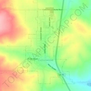
Name: Cottonwood topographic map, elevation, terrain.
Location: Cottonwood, Idaho County, Idaho, 83522, United States (46.04143 -116.36392 46.06409 -116.33712)
Average elevation: 3,606 ft
Minimum elevation: 3,389 ft
Maximum elevation: 3,825 ft
Idaho County trails, hiking, mountain biking, running and outdoor activities
Other topographic maps
Click on a map to view its topography, its elevation and its terrain.