
Ladonia topographic map
Interactive map
Click on the map to display elevation.
About this map
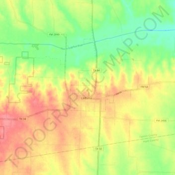
Name: Ladonia topographic map, elevation, terrain.
Location: Ladonia, Fannin County, Texas, 75449, United States (33.39898 -96.02121 33.46324 -95.90625)
Average elevation: 584 ft
Minimum elevation: 463 ft
Maximum elevation: 696 ft
Fannin County trails, hiking, mountain biking, running and outdoor activities
Other topographic maps
Click on a map to view its topography, its elevation and its terrain.