
Ilesboro topographic map
Interactive map
Click on the map to display elevation.
About this map
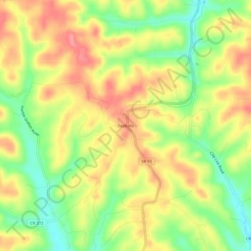
Name: Ilesboro topographic map, elevation, terrain.
Location: Ilesboro, Hocking County, Ohio, United States (39.41479 -82.47321 39.45479 -82.43321)
Average elevation: 955 ft
Minimum elevation: 794 ft
Maximum elevation: 1,096 ft
Hocking County trails, hiking, mountain biking, running and outdoor activities
Other topographic maps
Click on a map to view its topography, its elevation and its terrain.