
Hayesville topographic map
Interactive map
Click on the map to display elevation.
About this map
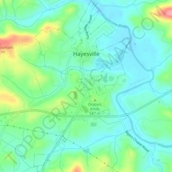
Name: Hayesville topographic map, elevation, terrain.
Location: Hayesville, Clay County, North Carolina, United States (35.02421 -83.82989 35.05616 -83.80778)
Average elevation: 1,880 ft
Minimum elevation: 1,778 ft
Maximum elevation: 2,165 ft
Clay County trails, hiking, mountain biking, running and outdoor activities
Other topographic maps
Click on a map to view its topography, its elevation and its terrain.