
Grand Ledge topographic map
Interactive map
Click on the map to display elevation.
About this map
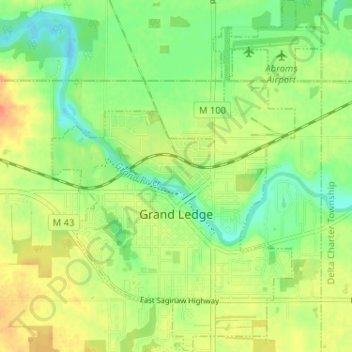
Name: Grand Ledge topographic map, elevation, terrain.
Location: Grand Ledge, Eaton County, Michigan, United States (42.73388 -84.76908 42.78112 -84.71978)
Average elevation: 850 ft
Minimum elevation: 784 ft
Maximum elevation: 922 ft
Eaton County trails, hiking, mountain biking, running and outdoor activities
Other topographic maps
Click on a map to view its topography, its elevation and its terrain.
Grand Ledge
United States > Michigan > Eaton County > Grand Ledge > Grand Ledge
Average elevation: 850 ft