
Kendrick topographic map
Interactive map
Click on the map to display elevation.
About this map
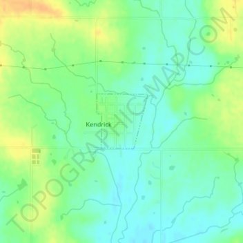
Name: Kendrick topographic map, elevation, terrain.
Location: Kendrick, Lincoln County, Oklahoma, United States (35.78205 -96.77835 35.78817 -96.77136)
Average elevation: 860 ft
Minimum elevation: 817 ft
Maximum elevation: 922 ft
Lincoln County trails, hiking, mountain biking, running and outdoor activities
Other topographic maps
Click on a map to view its topography, its elevation and its terrain.