
Marysville topographic map
Interactive map
Click on the map to display elevation.
About this map
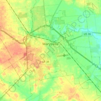
Name: Marysville topographic map, elevation, terrain.
Location: Marysville, Union County, Ohio, United States (40.18572 -83.41420 40.27397 -83.28363)
Average elevation: 1,010 ft
Minimum elevation: 948 ft
Maximum elevation: 1,076 ft
Union County trails, hiking, mountain biking, running and outdoor activities
Other topographic maps
Click on a map to view its topography, its elevation and its terrain.