
Thorsby topographic map
Interactive map
Click on the map to display elevation.
About this map
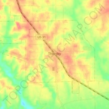
Name: Thorsby topographic map, elevation, terrain.
Location: Thorsby, Chilton County, Alabama, 35171, United States (32.89702 -86.75421 32.93428 -86.69170)
Average elevation: 653 ft
Minimum elevation: 535 ft
Maximum elevation: 745 ft
Chilton County trails, hiking, mountain biking, running and outdoor activities
Other topographic maps
Click on a map to view its topography, its elevation and its terrain.