
Youngsville topographic map
Interactive map
Click on the map to display elevation.
About this map
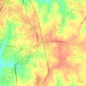
Name: Youngsville topographic map, elevation, terrain.
Location: Youngsville, Franklin County, North Carolina, United States (36.00606 -78.50007 36.04286 -78.46252)
Average elevation: 433 ft
Minimum elevation: 315 ft
Maximum elevation: 492 ft
Franklin County trails, hiking, mountain biking, running and outdoor activities
Other topographic maps
Click on a map to view its topography, its elevation and its terrain.