
Lincolnville topographic map
Interactive map
Click on the map to display elevation.
About this map
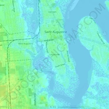
Name: Lincolnville topographic map, elevation, terrain.
Average elevation: 13 ft
Minimum elevation: -13 ft
Maximum elevation: 49 ft
Saint Johns County trails, hiking, mountain biking, running and outdoor activities
Other topographic maps
Click on a map to view its topography, its elevation and its terrain.
Castillo de San Marcos
United States > Florida > Saint Johns County > Saint Augustine
Average elevation: 7 ft