
Gardendale topographic map
Interactive map
Click on the map to display elevation.
About this map
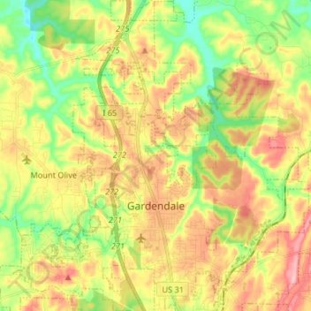
Name: Gardendale topographic map, elevation, terrain.
Location: Gardendale, Jefferson County, Alabama, United States (33.62271 -86.87332 33.73238 -86.74793)
Average elevation: 577 ft
Minimum elevation: 328 ft
Maximum elevation: 850 ft
Jefferson County trails, hiking, mountain biking, running and outdoor activities
Other topographic maps
Click on a map to view its topography, its elevation and its terrain.
Crestline Heights
United States > Alabama > Jefferson County > Mountain Brook
Average elevation: 791 ft
Biltmore Estates
United States > Alabama > Jefferson County > Vestavia Hills
Average elevation: 810 ft