
Cordova topographic map
Interactive map
Click on the map to display elevation.
Cordova
Cordova is a community in Shelby County, Tennessee, United States. Cordova lies east of Memphis, north of Germantown, south of Bartlett, and northwest of Collierville at an elevation of 361 feet (110 meters).
About this map
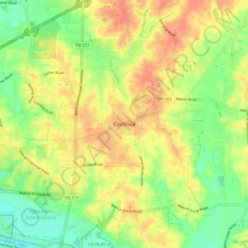
Name: Cordova topographic map, elevation, terrain.
Average elevation: 325 ft
Minimum elevation: 240 ft
Maximum elevation: 400 ft
Shelby County trails, hiking, mountain biking, running and outdoor activities
Other topographic maps
Click on a map to view its topography, its elevation and its terrain.