
Reily topographic map
Interactive map
Click on the map to display elevation.
About this map
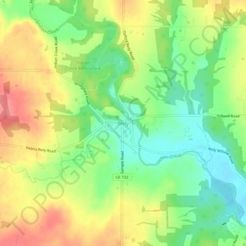
Name: Reily topographic map, elevation, terrain.
Location: Reily, Reily Township, Butler County, Ohio, United States (39.41366 -84.78106 39.45366 -84.74106)
Average elevation: 837 ft
Minimum elevation: 709 ft
Maximum elevation: 988 ft
Butler County trails, hiking, mountain biking, running and outdoor activities