
Ozona topographic map
Interactive map
Click on the map to display elevation.
About this map
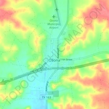
Name: Ozona topographic map, elevation, terrain.
Location: Ozona, Crockett County, Texas, 76943, United States (30.68989 -101.23682 30.73562 -101.17330)
Average elevation: 2,411 ft
Minimum elevation: 2,316 ft
Maximum elevation: 2,539 ft
Crockett County trails, hiking, mountain biking, running and outdoor activities
Other topographic maps
Click on a map to view its topography, its elevation and its terrain.