
Brown Lake topographic map
Interactive map
Click on the map to display elevation.
About this map
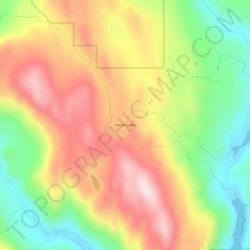
Name: Brown Lake topographic map, elevation, terrain.
Average elevation: 2,359 ft
Minimum elevation: 1,549 ft
Maximum elevation: 3,182 ft
Other topographic maps
Click on a map to view its topography, its elevation and its terrain.
Green Lake
United States of America > Washington > Okanogan County > Brown Lake
Average elevation: 2,224 ft