
Sant Celoni topographic map
Interactive map
Click on the map to display elevation.
About this map
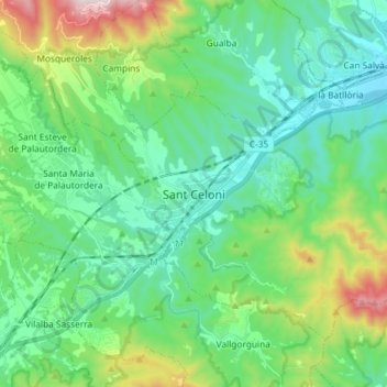
Name: Sant Celoni topographic map, elevation, terrain.
Location: Sant Celoni, Vallès Oriental, Barcelona, Catalonia, 08470, Spain (41.64853 2.46297 41.73049 2.60880)
Average elevation: 883 ft
Minimum elevation: 266 ft
Maximum elevation: 2,812 ft