
Wooster topographic map
Interactive map
Click on the map to display elevation.
About this map
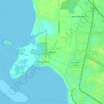
Name: Wooster topographic map, elevation, terrain.
Location: Wooster, Baytown, Harris County, Texas, United States (29.73578 -95.05493 29.77578 -95.01493)
Average elevation: 16 ft
Minimum elevation: -7 ft
Maximum elevation: 46 ft
Harris County trails, hiking, mountain biking, running and outdoor activities