
Bells Mill topographic map
Interactive map
Click on the map to display elevation.
About this map
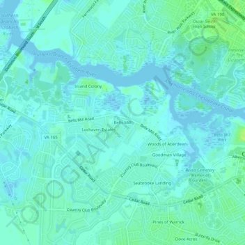
Name: Bells Mill topographic map, elevation, terrain.
Location: Bells Mill, Chesapeake, Virginia, United States (36.70348 -76.29466 36.74348 -76.25466)
Average elevation: 13 ft
Minimum elevation: -26 ft
Maximum elevation: 39 ft
Virginia trails, hiking, mountain biking, running and outdoor activities
Other topographic maps
Click on a map to view its topography, its elevation and its terrain.