
Canada Lake topographic map
Click on the map to display elevation.
About this map
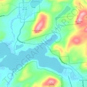
Name: Canada Lake topographic map, elevation, terrain.
Average elevation: 1,699 ft
Minimum elevation: 1,522 ft
Maximum elevation: 2,159 ft
Fulton County trails, hiking, mountain biking, running and outdoor activities
Other topographic maps
Click on a map to view its topography, its elevation and its terrain.
Great Sacandaga Lake
United States > New York > Fulton County > Town of Hadley
Average elevation: 1,214 ft
West Caroga Lake
United States > New York > Fulton County > Town of Caroga > Caroga Lake
Average elevation: 1,522 ft