
Alma topographic map
Interactive map
Click on the map to display elevation.
About this map
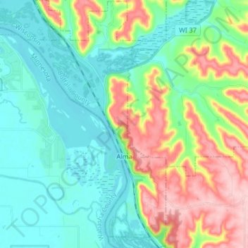
Name: Alma topographic map, elevation, terrain.
Location: Alma, Buffalo County, Wisconsin, United States (44.28612 -91.96682 44.37873 -91.89313)
Average elevation: 840 ft
Minimum elevation: 646 ft
Maximum elevation: 1,283 ft
Buffalo County trails, hiking, mountain biking, running and outdoor activities
Other topographic maps
Click on a map to view its topography, its elevation and its terrain.