
Thornton Lakes topographic map
Interactive map
Click on the map to display elevation.
About this map
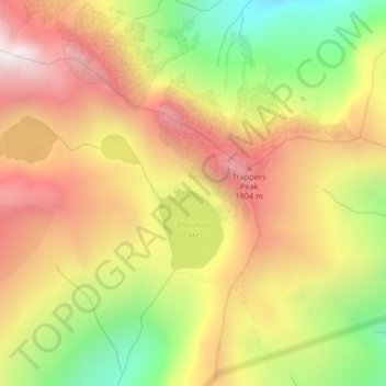
Name: Thornton Lakes topographic map, elevation, terrain.
Average elevation: 4,583 ft
Minimum elevation: 2,441 ft
Maximum elevation: 6,421 ft
Other topographic maps
Click on a map to view its topography, its elevation and its terrain.
Lower Queen Anne
United States of America > Washington > Seattle > Lower Queen Anne
Average elevation: 102 ft
Kruse Junction
United States of America > Washington > Marysville > Kruse Junction
Average elevation: 79 ft
Brown Lake
United States of America > Washington > Okanogan County > Brown Lake
Average elevation: 2,359 ft
Green Lake
United States of America > Washington > Okanogan County > Brown Lake
Average elevation: 2,224 ft