
Loretto topographic map
Interactive map
Click on the map to display elevation.
About this map
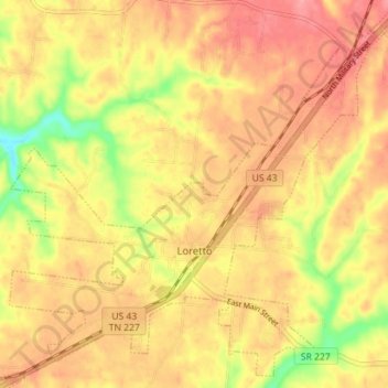
Name: Loretto topographic map, elevation, terrain.
Average elevation: 817 ft
Minimum elevation: 630 ft
Maximum elevation: 922 ft
Lawrence County trails, hiking, mountain biking, running and outdoor activities
Other topographic maps
Click on a map to view its topography, its elevation and its terrain.
Lawrenceburg
United States > Tennessee > Lawrence County > Lawrenceburg
The city of Lawrenceburg has a total area of 12.6 square miles (33 km2). It is the largest city on the state line between Chattanooga and Memphis. Located on the southern Highland Rim, Lawrence County and Lawrenceburg are set atop of a large mountain plateau of the Appalachian Mountain range with elevations…
Average elevation: 912 ft