Geolocate

Hail Creek topographic map

Interactive map

Click on the map to display elevation.

About this map

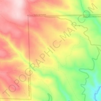
Name: Hail Creek topographic map, elevation, terrain.

Location: Hail Creek, Crook County, Oregon, United States of America (44.22241 -120.17710 44.24846 -120.12697)

Average elevation: 4,633 ft

Minimum elevation: 3,986 ft

Maximum elevation: 5,102 ft

Other topographic maps

Click on a map to view its topography, its elevation and its terrain.

Redmond

United States of America > Oregon > Redmond

Average elevation: 3,015 ft

Forfar

United States of America > Oregon > Forfar

Average elevation: 98 ft

Wimer

United States of America > Oregon > Wimer

Average elevation: 1,368 ft

Thousand Springs

United States of America > Oregon

Average elevation: 5,039 ft

Pilot Rock

United States of America > Oregon > Pilot Rock

Average elevation: 1,729 ft

Springwater

United States of America > Oregon > Springwater

Average elevation: 1,014 ft