
Lake Hamilton topographic map
Interactive map
Click on the map to display elevation.
About this map
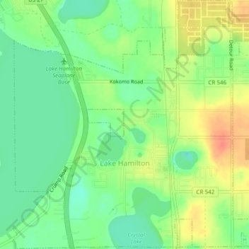
Name: Lake Hamilton topographic map, elevation, terrain.
Location: Lake Hamilton, Polk County, Florida, 33851, United States (28.03293 -81.64484 28.06624 -81.60743)
Average elevation: 141 ft
Minimum elevation: 69 ft
Maximum elevation: 233 ft
Polk County trails, hiking, mountain biking, running and outdoor activities
Other topographic maps
Click on a map to view its topography, its elevation and its terrain.
Lakeland Highlands
United States > Florida > Polk County > Lakeland Highlands
Average elevation: 210 ft