
Rhineland topographic map
Click on the map to display elevation.
Exploring new terrains?
Equip yourself with the best gear to stay safe, comfortable, and prepared:
As an Amazon Associate, I earn from qualifying purchases at no extra cost to you.
About this map
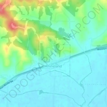
Name: Rhineland topographic map, elevation, terrain.
Average elevation: 564 ft
Minimum elevation: 499 ft
Maximum elevation: 748 ft