

Aberdeen topographic map
Click on the map to display elevation.
Aberdeen
Aberdeen is at the eastern end of Grays Harbor, near the mouth of the Chehalis River and southwest of the Olympic Mountains. Grays Harbor is notable as the northernmost ria on North America's Pacific Coast because it has remained free of glaciers throughout the Quaternary due to unfavorable topography and warm temperatures. It is thought that, during glacial periods of the Quaternary, the Chehalis River was a major refugium for aquatic species, as was the west coast from the Olympic Peninsula southward for plants that later formed the northern part of the Pacific temperate rainforest in formerly glaciated areas.
About this map
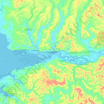
Name: Aberdeen topographic map, elevation, terrain.
Average elevation: 217 ft
Minimum elevation: -16 ft
Maximum elevation: 938 ft
Grays Harbor County trails, hiking, mountain biking, running and outdoor activities