
Eldred topographic map
Interactive map
Click on the map to display elevation.
About this map
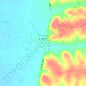
Name: Eldred topographic map, elevation, terrain.
Location: Eldred, Greene County, Illinois, 62027, United States (39.28306 -90.55968 39.28930 -90.54868)
Average elevation: 502 ft
Minimum elevation: 420 ft
Maximum elevation: 666 ft
Greene County trails, hiking, mountain biking, running and outdoor activities
Other topographic maps
Click on a map to view its topography, its elevation and its terrain.