
Make a donation
Gear up for your next adventure:
As an Amazon Associate, this site earns from qualifying purchases at no extra cost to you.
Laytonville topographic map
Click on the map to display elevation.
Make a donation
Gear up for your next adventure:
As an Amazon Associate, this site earns from qualifying purchases at no extra cost to you.
Laytonville
Laytonville is a census-designated place (CDP) in Mendocino County, California, United States. Laytonville, is located 20 miles (32 km) north-northwest of Willits, at an elevation of 1670 feet (509 m). The population was 1,227 at the 2010 census, down from 1,301 at the 2000 census.
Make a donation
Gear up for your next adventure:
As an Amazon Associate, this site earns from qualifying purchases at no extra cost to you.
About this map
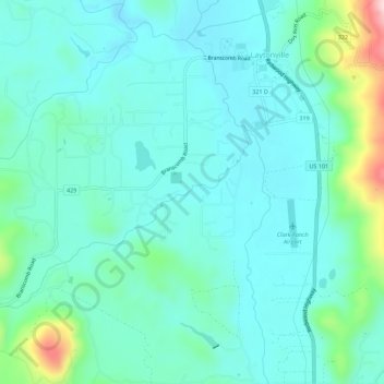
Name: Laytonville topographic map, elevation, terrain.
Average elevation: 1,759 ft
Minimum elevation: 1,575 ft
Maximum elevation: 2,549 ft
Mendocino County trails, hiking, mountain biking, running and outdoor activities
Make a donation
Gear up for your next adventure:
As an Amazon Associate, this site earns from qualifying purchases at no extra cost to you.