
Spoon River topographic map
Interactive map
Click on the map to display elevation.
About this map
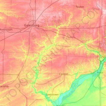
Name: Spoon River topographic map, elevation, terrain.
Average elevation: 663 ft
Minimum elevation: 417 ft
Maximum elevation: 899 ft
Other topographic maps
Click on a map to view its topography, its elevation and its terrain.
Jaycee Memorial Park
United States of America > Illinois > Deerfield > Deerfield
Average elevation: 676 ft