
Gladstone topographic map
Interactive map
Click on the map to display elevation.
About this map
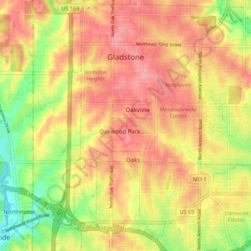
Name: Gladstone topographic map, elevation, terrain.
Location: Gladstone, Clay County, Missouri, United States (39.17408 -94.59427 39.23524 -94.52662)
Average elevation: 925 ft
Minimum elevation: 751 ft
Maximum elevation: 1,037 ft
Clay County trails, hiking, mountain biking, running and outdoor activities
Other topographic maps
Click on a map to view its topography, its elevation and its terrain.