
Cedar Falls topographic map
Interactive map
Click on the map to display elevation.
About this map
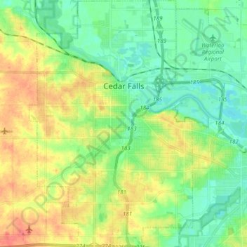
Name: Cedar Falls topographic map, elevation, terrain.
Location: Cedar Falls, Black Hawk County, Iowa, United States (42.46432 -92.50479 42.57412 -92.40610)
Average elevation: 912 ft
Minimum elevation: 837 ft
Maximum elevation: 1,037 ft
Black Hawk County trails, hiking, mountain biking, running and outdoor activities