
Mason City topographic map
Interactive map
Click on the map to display elevation.
About this map
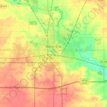
Name: Mason City topographic map, elevation, terrain.
Location: Mason City, Cerro Gordo County, Iowa, United States (43.10464 -93.28039 43.18411 -93.11245)
Average elevation: 1,155 ft
Minimum elevation: 1,040 ft
Maximum elevation: 1,240 ft
Cerro Gordo County trails, hiking, mountain biking, running and outdoor activities
Other topographic maps
Click on a map to view its topography, its elevation and its terrain.
Clear Lake
United States > Iowa > Cerro Gordo County > Clear Lake > Clear Lake
Average elevation: 1,224 ft