
Canyon Ferry Lake topographic map
Interactive map
Click on the map to display elevation.
About this map
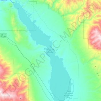
Name: Canyon Ferry Lake topographic map, elevation, terrain.
Average elevation: 4,731 ft
Minimum elevation: 3,642 ft
Maximum elevation: 8,730 ft
Other topographic maps
Click on a map to view its topography, its elevation and its terrain.
Townsend
United States > Montana > Broadwater County
Townsend, Broadwater County, Montana, United States
Average elevation: 3,825 ft