
Lake Temagami topographic map
Interactive map
Click on the map to display elevation.
About this map
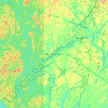
Name: Lake Temagami topographic map, elevation, terrain.
Average elevation: 1,073 ft
Minimum elevation: 886 ft
Maximum elevation: 1,690 ft
Other topographic maps
Click on a map to view its topography, its elevation and its terrain.
Marten River
Marten River, Pozniak Road, Unorganized North Nipissing, Temagami, Nipissing District, Ontario, P0H 1T0, Canada
Average elevation: 968 ft
Rabbit Lake
Rabbit Lake, Unorganized North Nipissing, Temagami, Nipissing District, Northeastern Ontario, Ontario, Canada
Average elevation: 1,053 ft
Obabika Lake
Obabika Lake, Unorganized North Nipissing, Temagami, Nipissing District, Northeastern Ontario, Ontario, Canada
Average elevation: 1,073 ft
Finlayson Point Provincial Park
Finlayson Point Provincial Park, Temagami, Nipissing District, Ontario, Canada
Average elevation: 1,014 ft